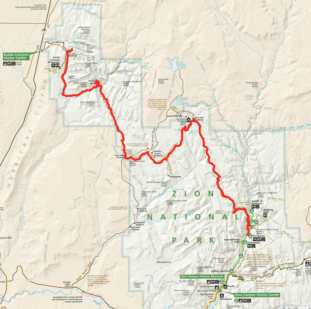
Zion National Park - Partial Zion Traverse

I was in Las Vegas for work and had a long-ish weekend due to moving from day shift to night shift. I decided this would be the perfect opportunity to plan a trip to Zion National Park for some wilderness backpacking. The park has a ton of trails but for multi-day trips of a backpacking nature (many more if you are canyoneering) a partial hike of the Trans-Zion Trek seemed like a good option. Due to time limitations, I decided to end my trip when I got to the main canyon and did not do the East Rim portion of the trek.
Disclaimer: Photo overload on this one, because there are so many great ones from this park.
Planning
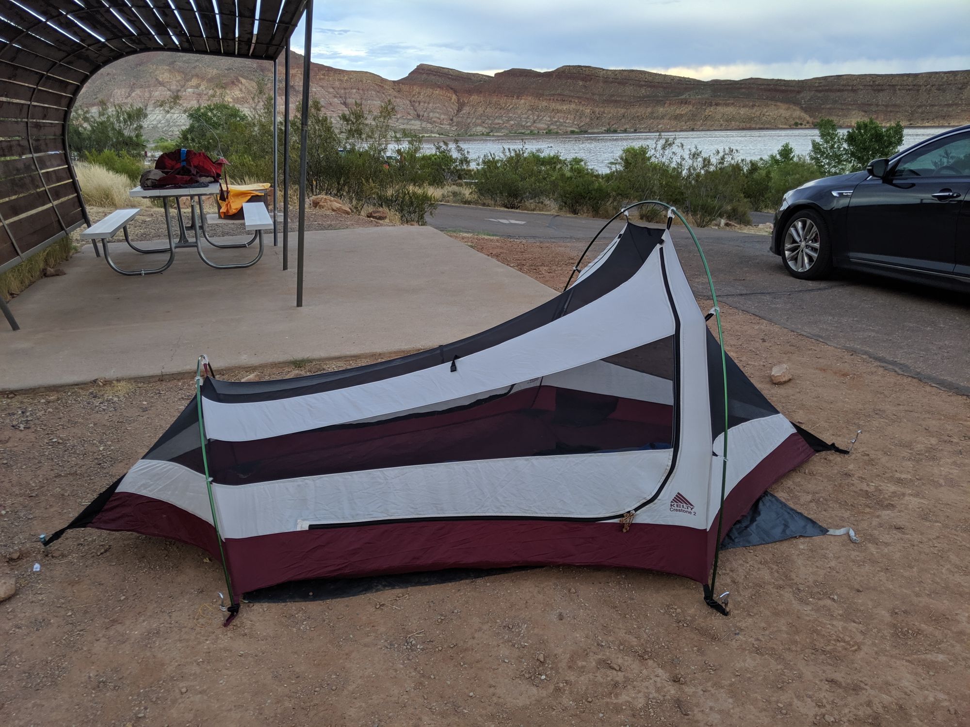
Friday Night: Camp at Quail Creek State Park. This put me 30-45 minutes from the park entrances where I needed to go to get my wilderness permit first thing in the morning. All campsites within Zion were already booked. In retrospect, there was probably some free BLM land in the area that I could have used as well.
Saturday (18.5 miles): Wake up early and go to the Visitor Center and attempt to get permits. The goal was to get a permit to camp "at large" in Wildcat Canyon on the Northgate Peaks trail and a permit for sites 1, 3, or 5 on the West Rim trail. 1 or 3 were most preferable.
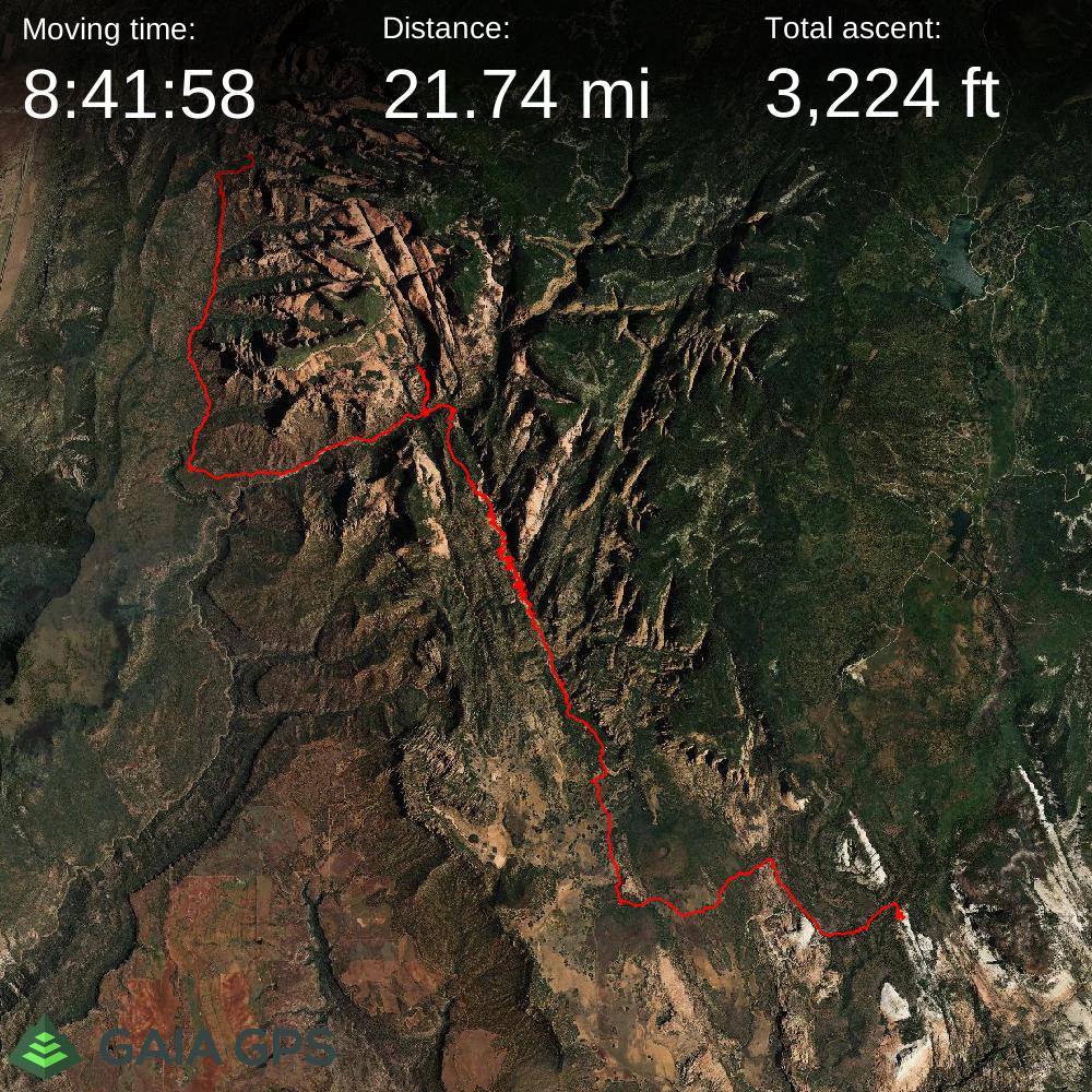
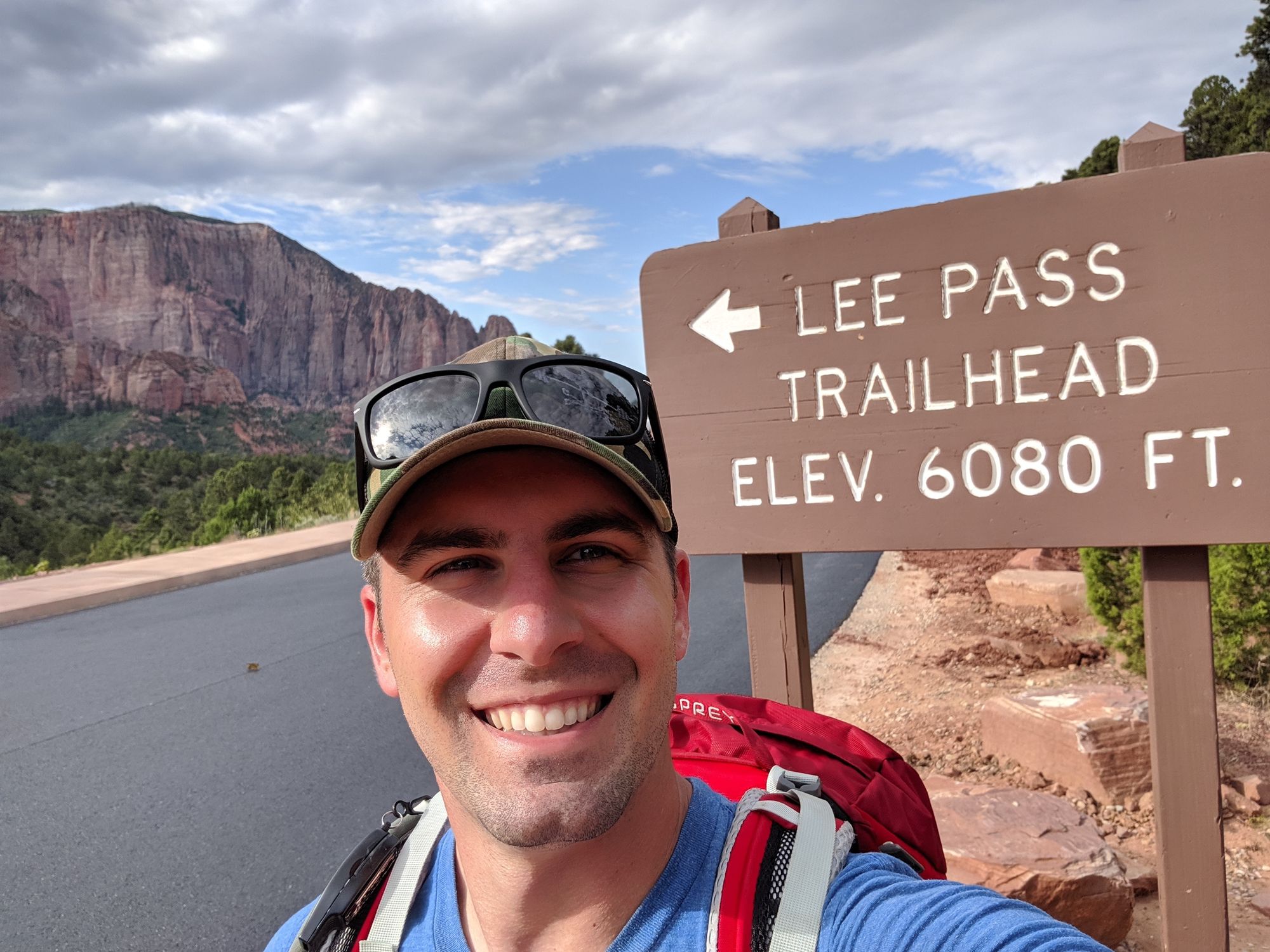
After getting my permits, I planned to drive to the Lee Pass trailhead on the northwest side of the park to start my hike off on the La Verkin Creek Trail, followed by Hop Valley and the Connector Trail to the Northgate Peaks.
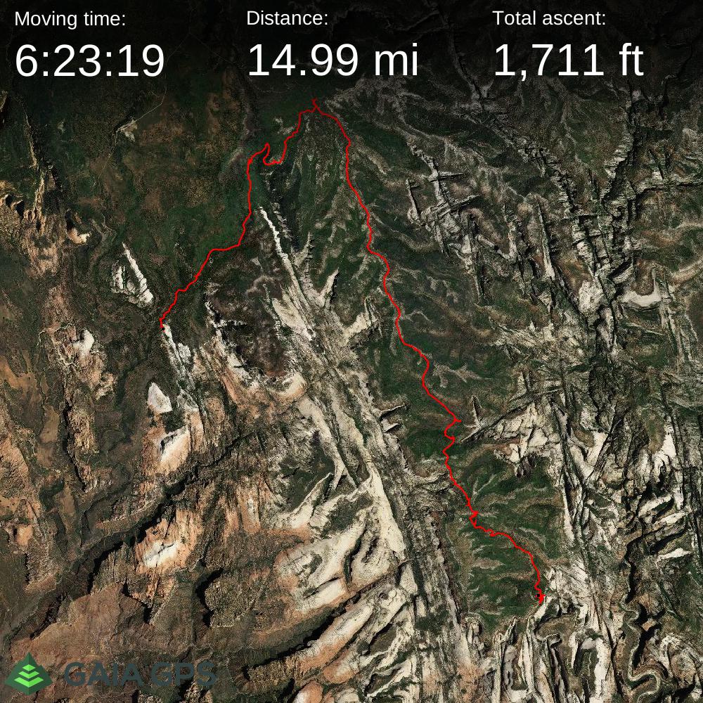
Sunday (14.5 miles): Hike Wildcat Canyon to the West Rim Trail and to either campsite 1, 3, or 5.
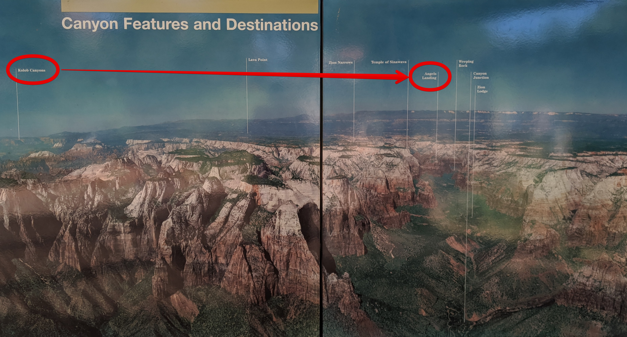
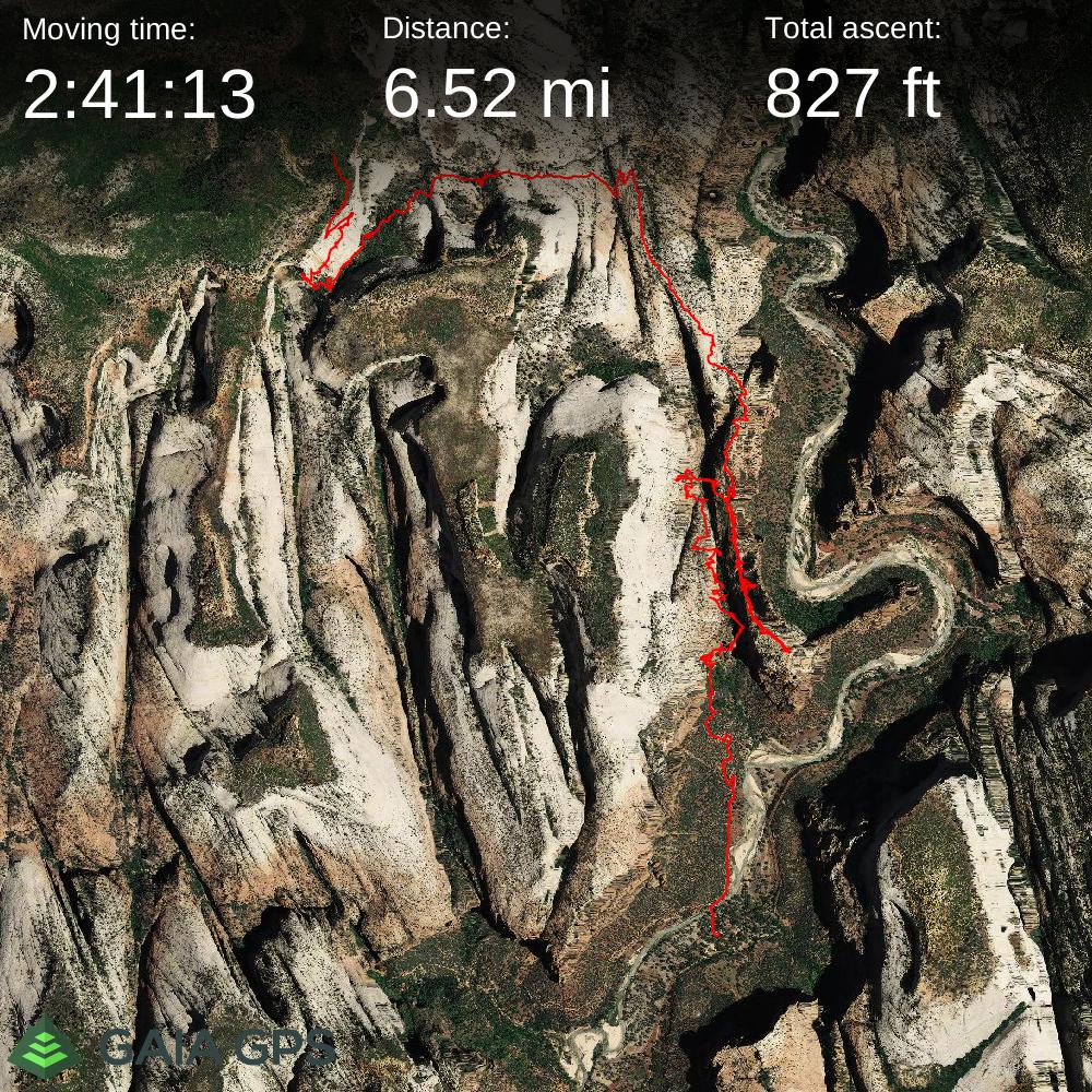
Monday (4.9 miles): Hike from my campsite along the West Rim Trail to Scout Lookout, stash my pack and do the Angel's Landing Hike, and then finish the West Rim Trail down to The Grotto and shuttle stop for a ride back to the VC. From the VC, catch paid shuttle back to my car at Lee Pass.
Total Mileage of around 38.5 miles.
Cost
- Quail Creek SP Campsite: $33
- Red Rock Shuttle (VC to Lee Pass): $40 (cash)
- Wilderness Permit: $15
- Total Direct Costs: $88
Plan Meets Reality
Overall my trip went almost exactly as planned, with a few minor hiccups.
Hiccup #1
On Friday afternoon, after I got off work around 1630, I figured I might just be able to drive to the Visitor center fast enough to get my permits Friday night, which would have allowed for an earlier (and cooler) Saturday morning start. Well...I forgot that Zion is in a different timezone than Las Vegas, so halfway there, just as I was starting to think I was going to make it, the clock switch and I realized I was an hour later than I had anticipated. No chance of getting permits Friday night.
Hiccup #2
On Saturday morning, I was relieved to get the exact campsites I wanted so that I could execute my primary plan. Unfortunately, when I got to the Lee Pass trailhead, the Park Rangers informed me that construction on the parking lot was starting before I would return and therefore would have to park my car at a lower trailhead... +0.5 miles, oh well.
Hiccup #3
At the end of my Saturday trek (over 19 miles with the parking lot detour), my knee was killing me. My last few miles were miserable. At this point, I was ready to throw in the towel. I decided I would camp as planned and see how I felt in the morning. I was within a mile of a parking area so figured I could bum an emergency ride if needed. In the morning, my knee still hurt and I waffled back and forth over what to do for a while. I finally decided to at least continue the hike for another 4.8 miles to another parking area. I figured even if I was extremely slow, I would make it by mid-day if I needed help. With extra and longer breaks along the way, my knee started to feel much better.
From there on out, everything was great. On Monday morning, my plan had been to get to and do Angel's Landing and then be back to the Visitor Center by 9 AM to be sure I had some buffer for my shuttle to the car. Well, I arrived at the VC on the Zion Shuttle at 9 AM to the minute.
The Trek
Aside from the few planning updates, the hike itself was AMAZING!
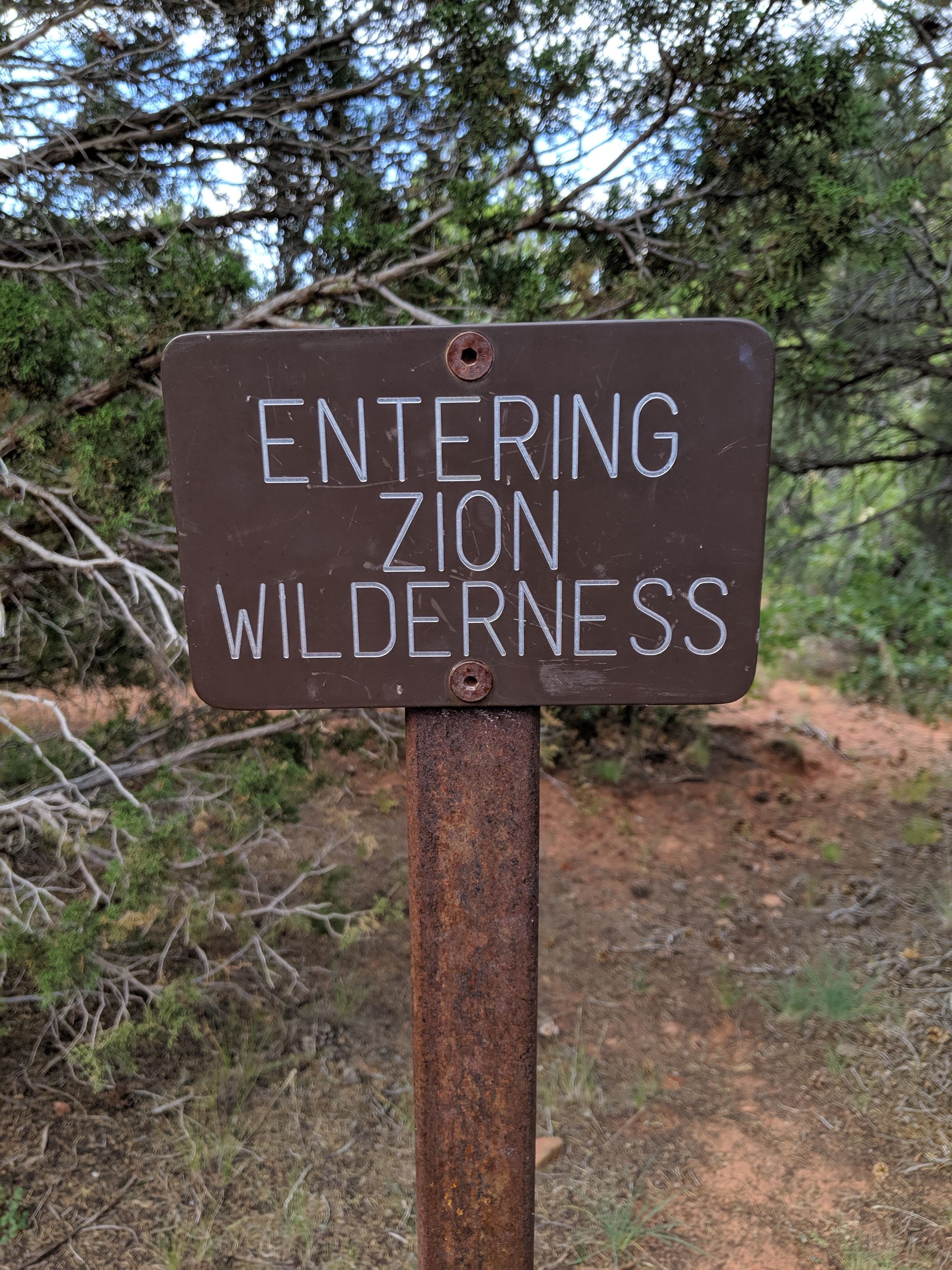
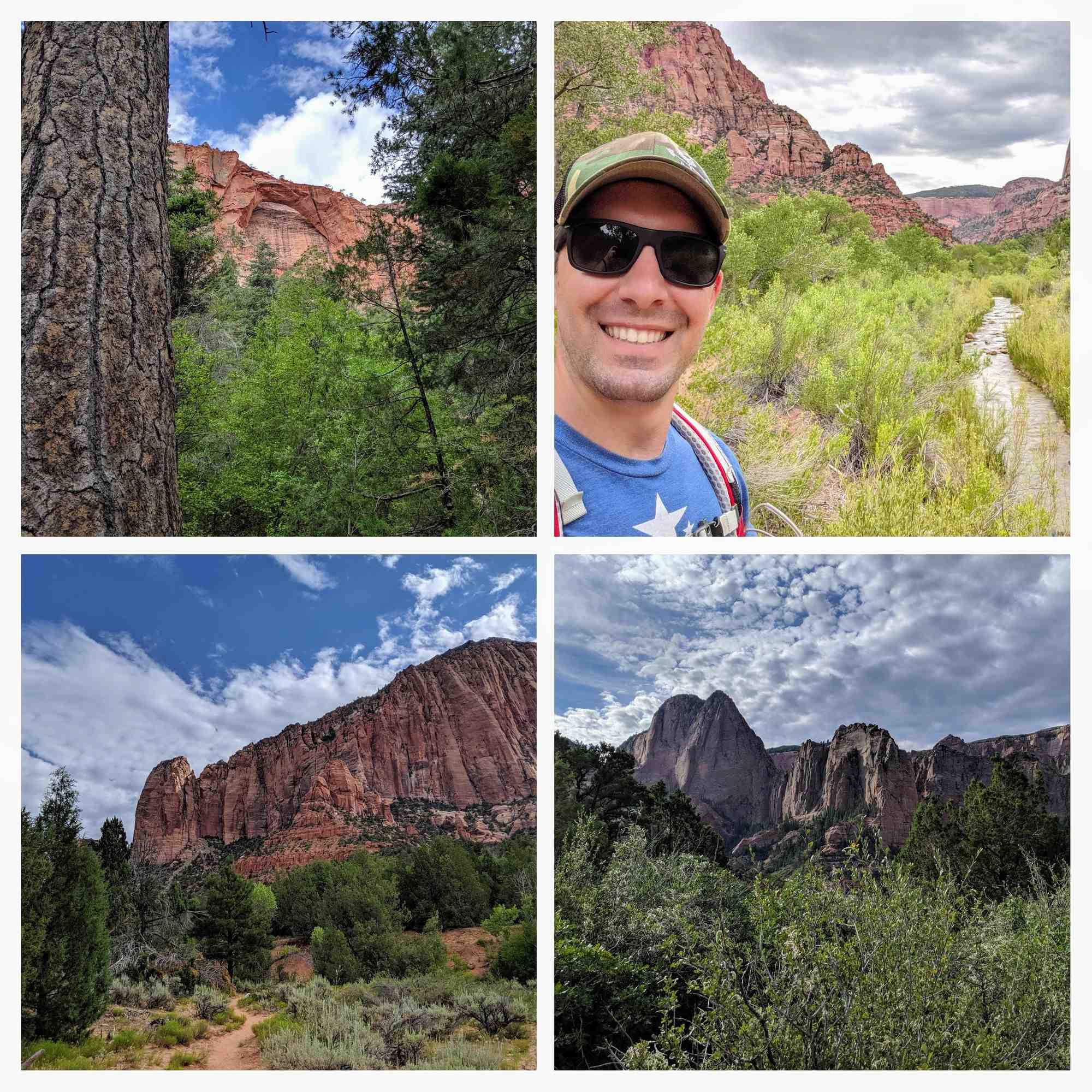
La Verkin Creek Trail
This trail started my trek. The trail is mostly downhill and skirts the Kolob Canyons which are massive and beautiful red stone cliffs all along the route. After the steep initial descent (glad I was going down) the trail follows the La Verkin Creek which was flowing more like a river due to all the rainfall this year. It was a beautiful trail and was not super difficult. There are even a few designated campsites along the river that looked like they would be a lot of fun. At the end, there is a spur trail to the Kolob Arch. After doing the spur, I took lunch back at the junction and topped off my water in one of the flows near the creek.
Hop Valley Trail
For all the good I said about the La Verkin Creek trail, Hop Valley was not as fun. Although the valley was beautiful and the shallow flow of the meandering creek made for some lush scenery, the intense mid-day heat and the soft sandy trail made this part not so enjoyable. Although shade was generally available near the trail, the trail itself was almost entirely uncovered and the soft sand persisted for probably 80% of the trail. My keychain thermometer showed the mid-day temps very near to 100˚F. Towards the end though, there were some beautiful flat meadows of what I think might have been wild wheat. By the time I arrived at the Hop Valley trailhead, my knee was in bad shape and I was thoroughly worn out; but I still had 4 miles to go for the day. I decided to take a long 45 minute break at the trailhead in the shade of the restrooms. Unfortunately, due to the proximity of pasture land to the Hop Valley Creek, water from the creek was not recommended as a water source and I was starting to get worried I might not have enough water for the rest of the evening.
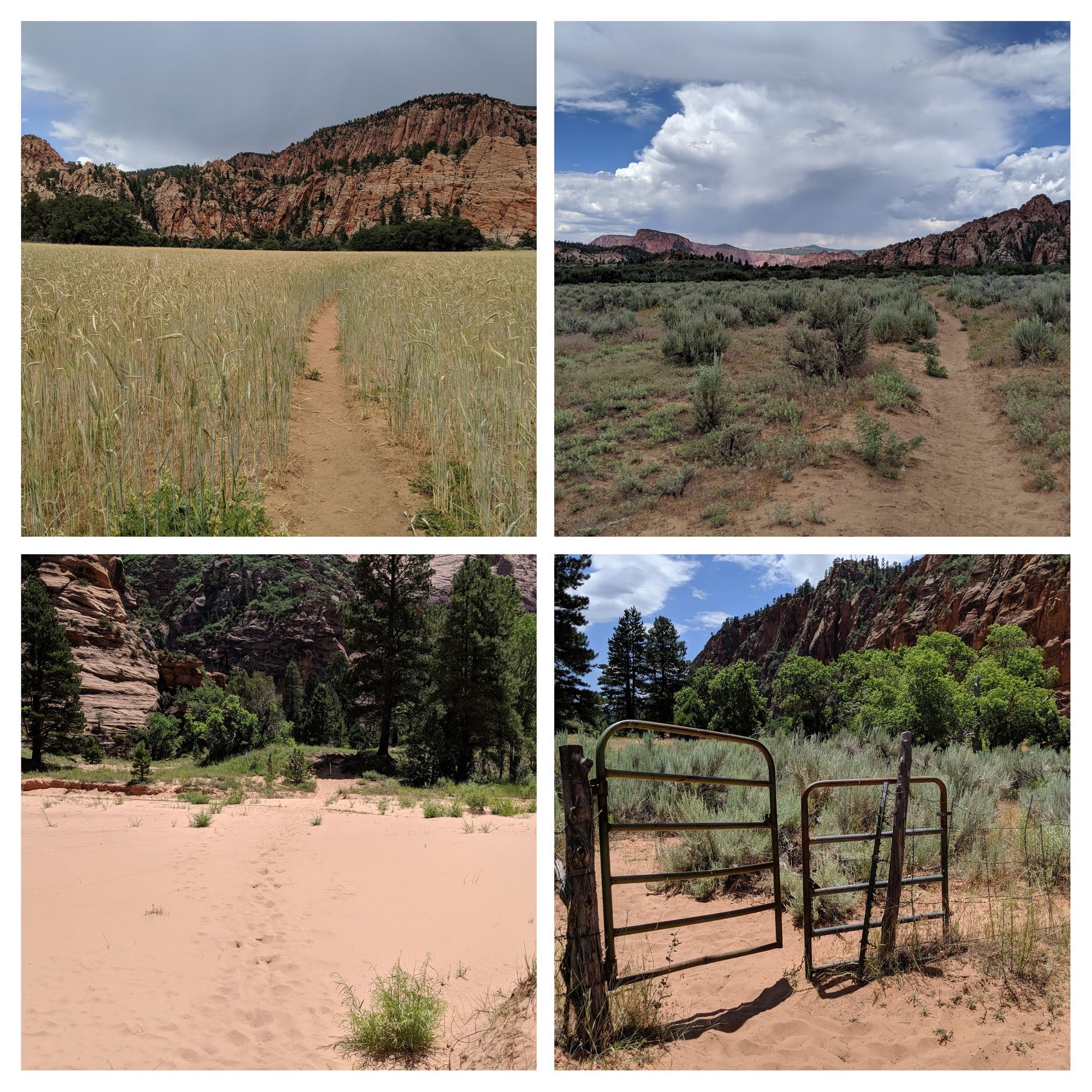
Connector Trail
No much to say about this trail other than it was just a sheer fight against the heat and my bum knee. It was along this trail that I started think I was going to have to bail the next morning. I also emptied my Camelback here, which left me with only 2 liters of water for the rest of the evening; a little deeper into my water reserves than I really wanted to be. The heat of Hop Valley had forced me through quite a bit of water.
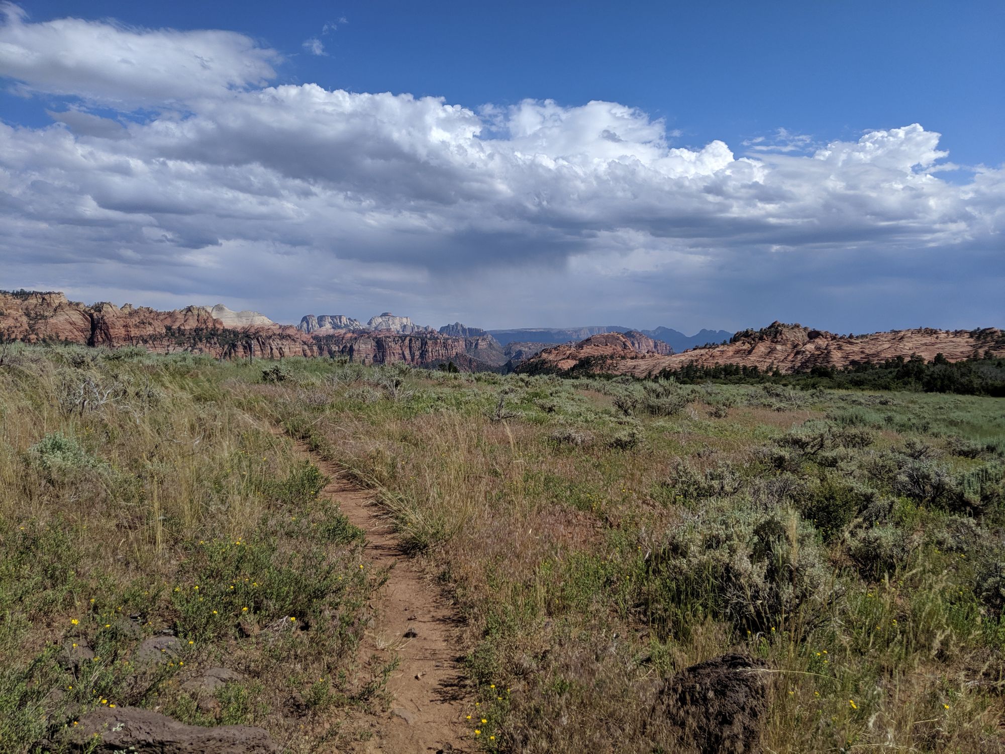
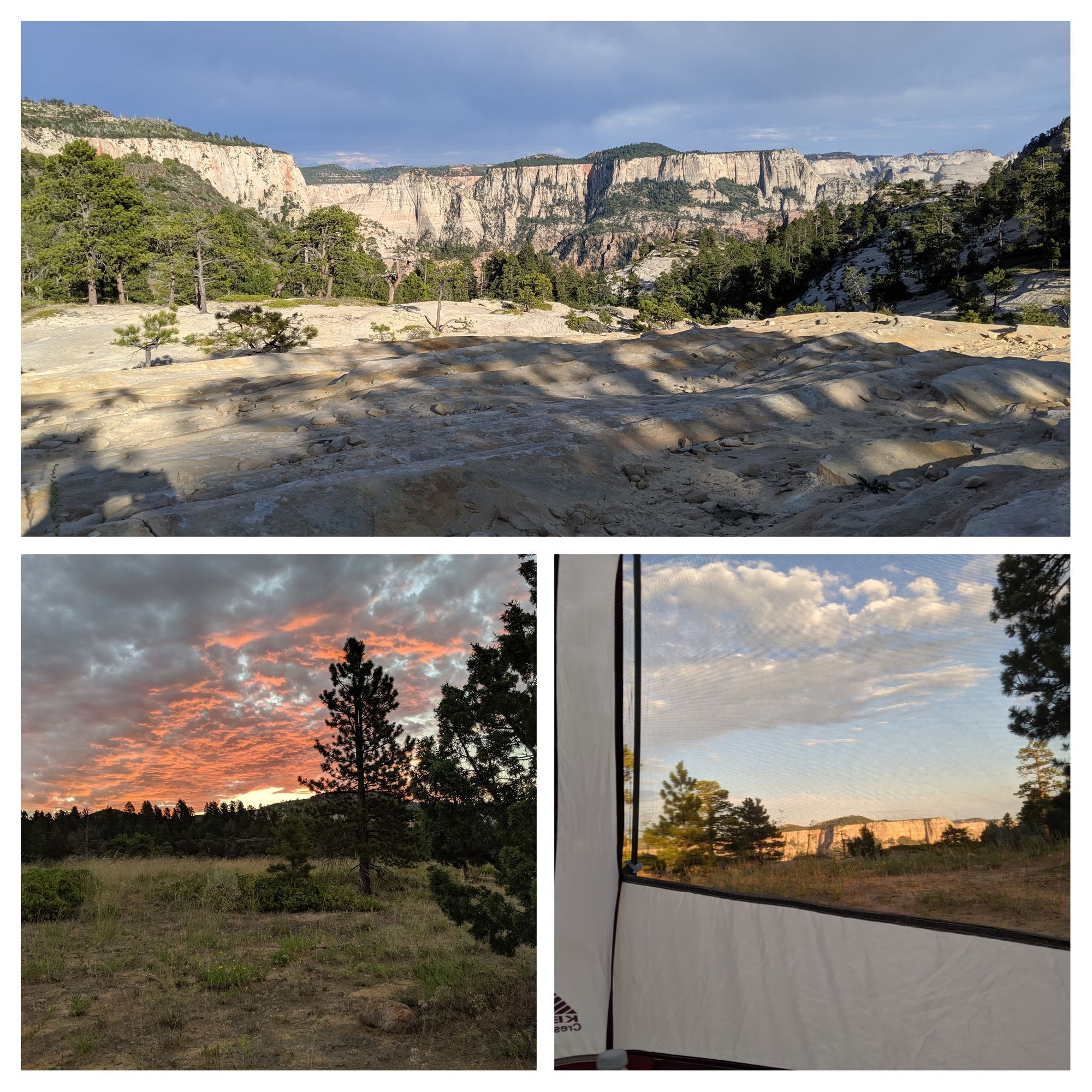
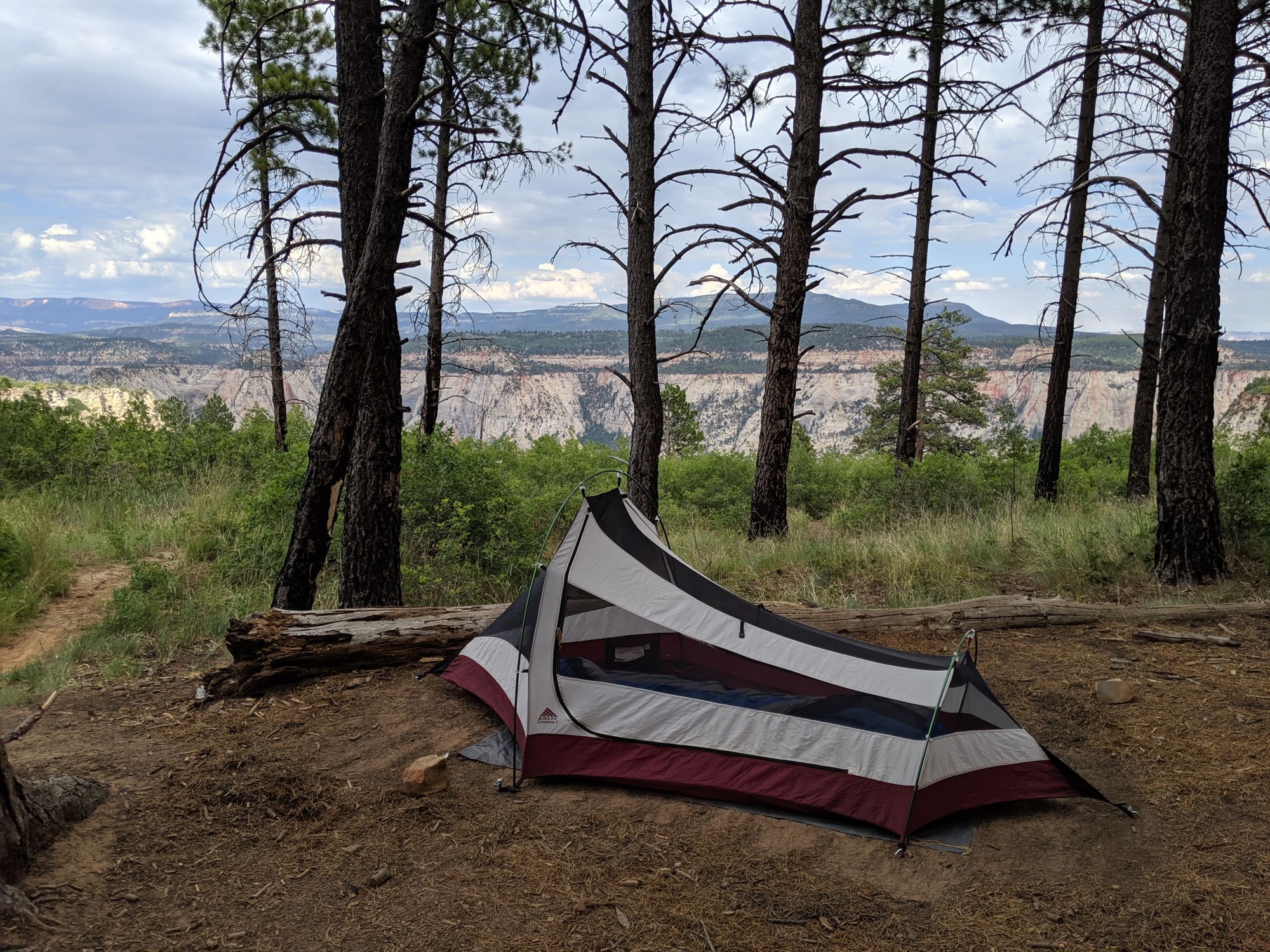
Northgate Peaks Trail - Camping
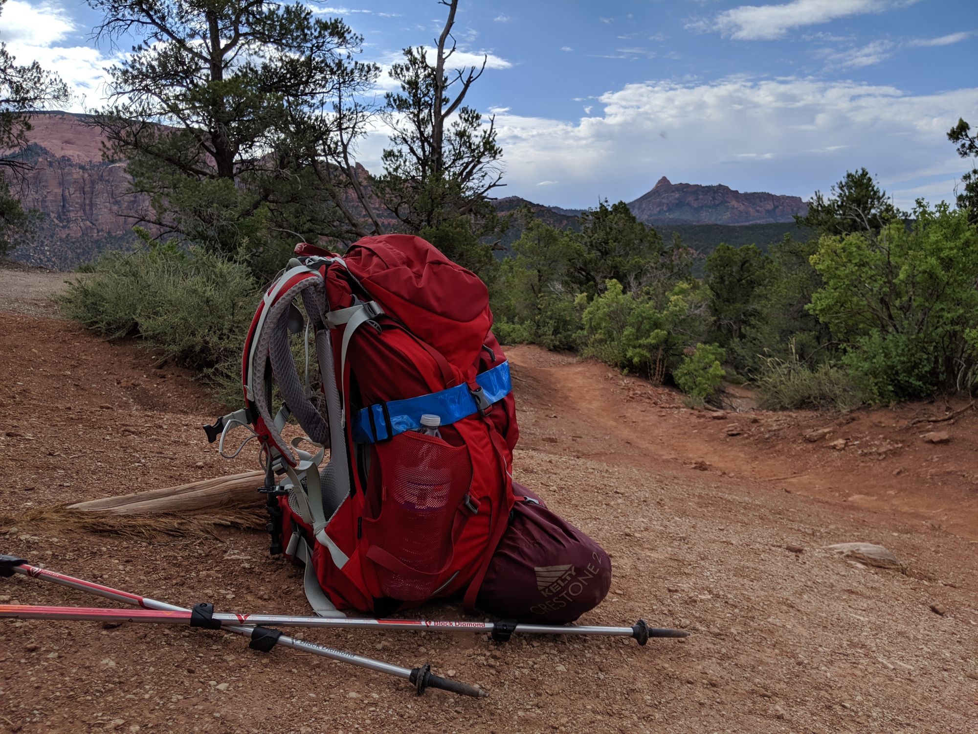
I finally arrived at the Northgate Peaks Trail, which is designated as an "at-large" camping area. Although I would have loved to have hiked further down the 1 mile spur trail to see more of the peaks, my knee was not going to allow that. So I found a nice spot overlooking a canyon and made camp. The views from this area were stunning. I made dinner and found a spot to eat while I took in the views. After some stretching (to see if I could fix my knee) I turned in for the night. At this point I only had about half a liter of water left, my knee hurt, and I realized that my inflatable sleeping pad had a slow leak that resulted in an empty mat after about an hour. Although I had a patch kit, I could not find the leak.
With the three strikes of pain, low water, and no sleeping pad, I was pretty much settled on finding a way home from the trailhead the next day.
In the morning I got up early, hoping to catch any shuttle that might be dropping folks off at the trailhead. At the junction between the Northgate Peak Trail, the Wildcat Canyon Trail, and the trail to the parking lot, I hesitated for about 5 minutes trying to decide what to do. After much deliberation, I finally decided to press on. I would continue the 4.8 miles to the West Rim Trailhead with a planned stop at 2-3 miles to see if water was available at Wildcat Spring. If water was available and my knee felt ok, I would continue the trip.
Wildcat Canyon Trail
A combination of a slower pace (GPS revealed only slightly slower), more frequent, and longer breaks seemed to do the trick to making my knee feel better...also some Aleve may have helped. I arrived at Wildcat Springs which was flowing nicely in good spirits and mostly pain free. I finished my remaining water from the night before and topped off all of my water vessels. I also opted to take a longer break and make myself a cup of coffee from the spring water. Revitalized with coffee and water I pressed on.
The trail offered great views of the large Wildcat Canyon. Although not as impressive as the main canyon or the Kolob Canyons, this trail had views of much different rock formations and much more vegetation. A combination of cooler morning temperatures and abundant shade made this part of the trail really enjoyable.
By the time I arrived at the West Rim Trailhead, my knee was feeling much better and was not giving me much grief at all. With ample daylight remaining, I knew I could continue with the slower pace and frequent breaks to make it to Campsite #1 easily before dark.
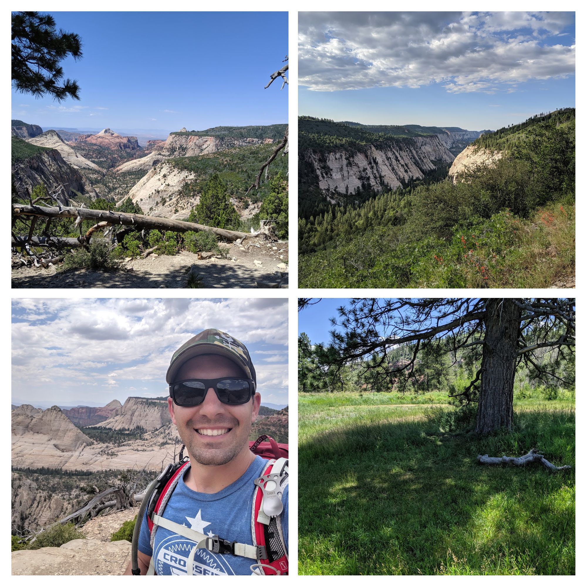
West Rim Trail
The West Rim Trail was much more exciting in anticipation of arriving at the main canyon than in the trail itself. Although there were some pretty cool views from the trail, the trail meanders along the Horse Pasture Plateau and s mostly just rolling hills without a whole lot of elevation gain or loss. I took a hour-long lunch on top of one of the hills with a decent view to rest my legs. Potato Hollow on the other hand was a gorgeous oasis along the plateau.
Potato Hollow is a low spot with a strongly flowing spring that has created this lush green area in the middle of desert type climates. If you ever end up here and decide to take a break, don't stop at the trail junction, hike a few hundred feet down the spring trail where there is a gorgeous shade tree right next to the spring. After topping off my water and taking a short break, I continued on.
After a short break at the trail split (two paths to rejoin West Rim Trail) I finished my hike to Campsite #1. "Woah!" is all I can say. Although I knew I was up on a plateau for most of the trail, I did not realize how deeply cut the surrounding canyons were. My campsite overlooked a huge canyon below. The anticipation for my hike into the main canyon the next morning was building.
I topped off with water again at Cabin Spring (named for the remaining foundation of a cabin nearby) and made myself some dinner before turning in early to avoid the ferocious bugs.
Angel's Landing
The next morning I rose early at 5 AM to finish my hike to Angel's Landing and back to The Grotto for extraction. My goal was to arrive at Angel's Landing before anyone from the shuttle could make it up. I was really hoping to be the first one up.
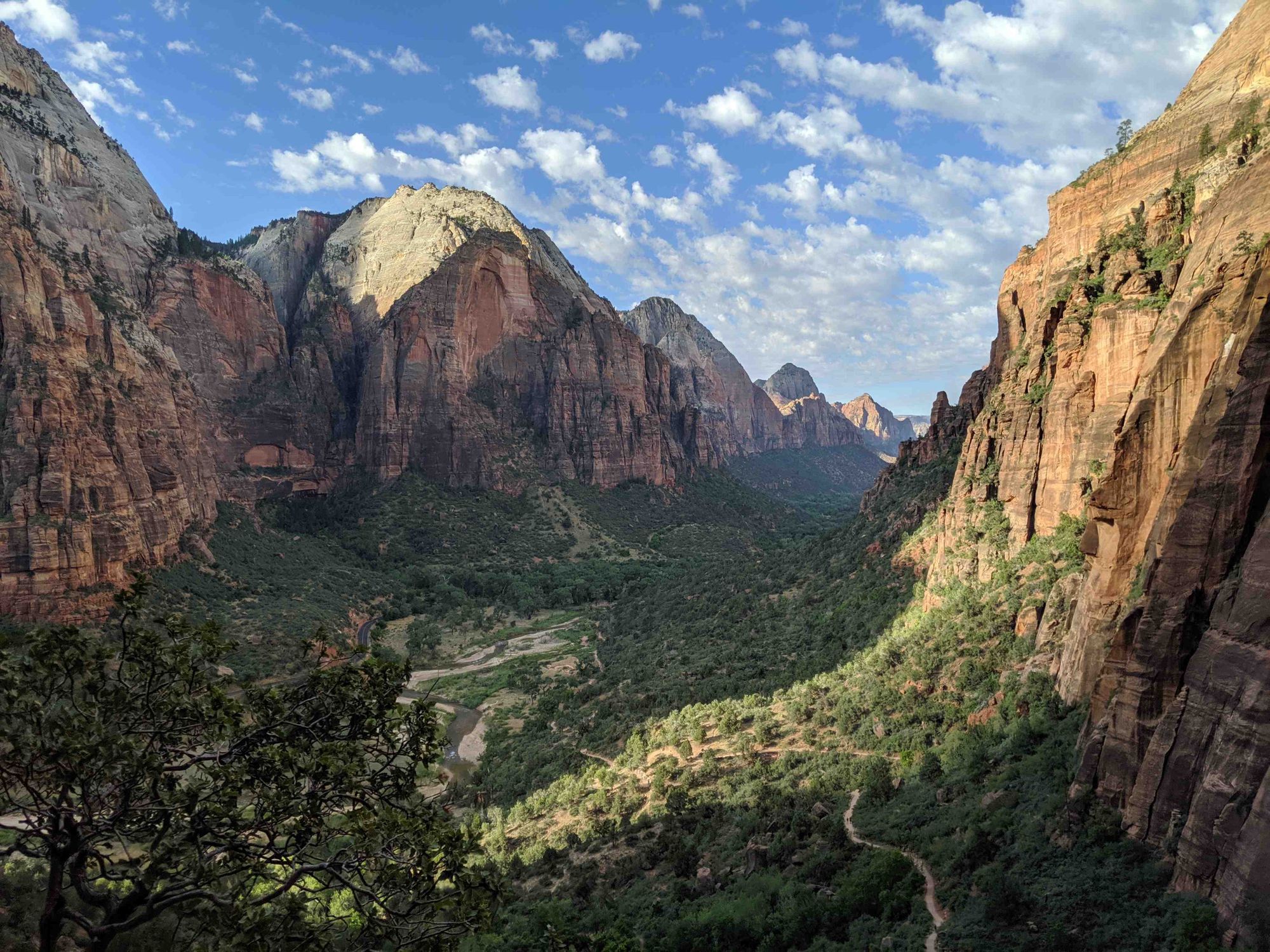
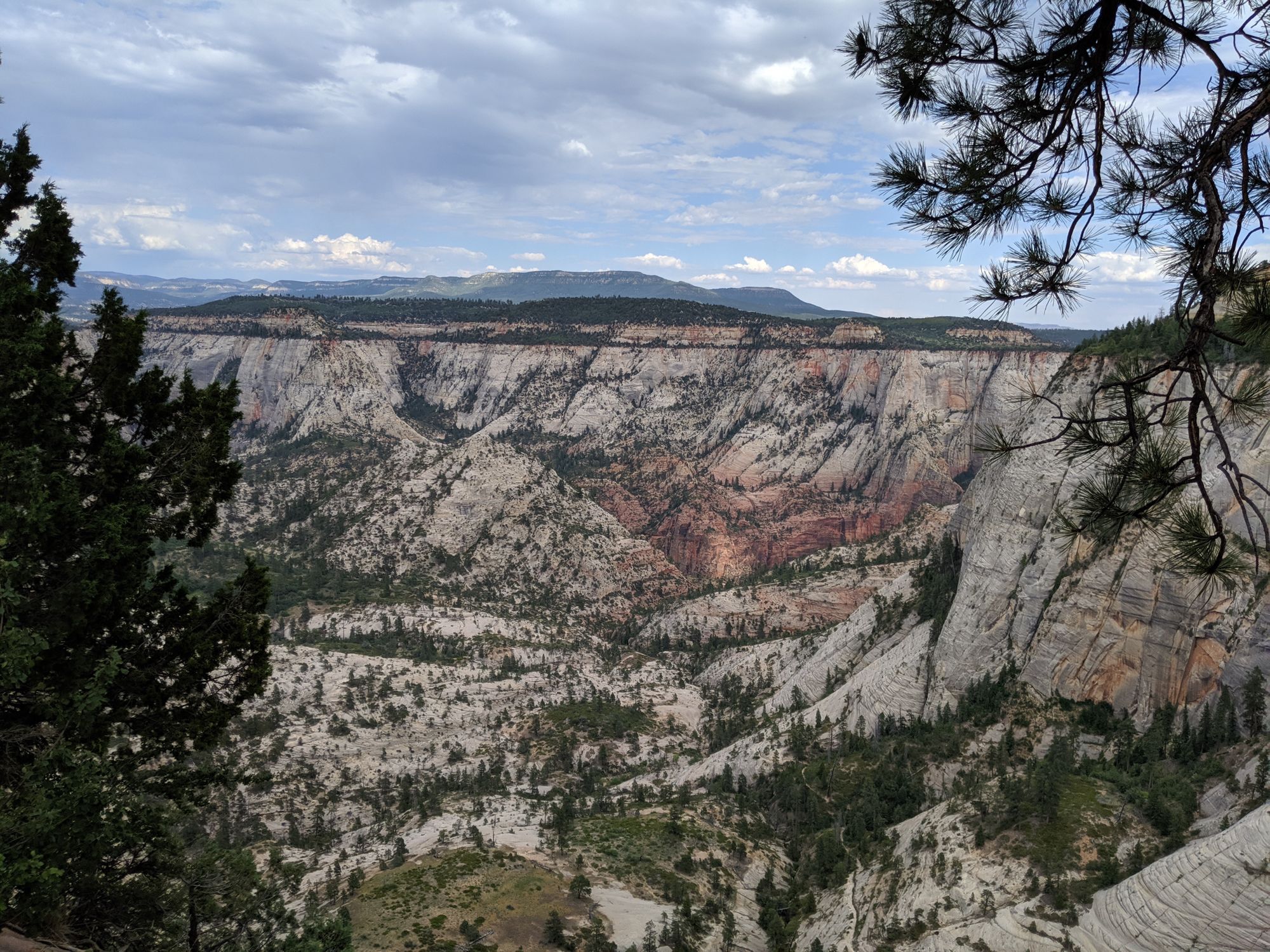
Immediately upon starting out from my campsite the trail takes a steep dive down into the canyon that my campsite was overlooking. The trail guide mentions a 3,400 foot descent into the main canyon. Down and down I went, thinking I was very near to the bottom when I rounded a turn and could finally see into the main canyon...I was not even close to the bottom. The sheer magnitude of the canyon was mind-boggling. I could not even fathom such a deep canyon. This is likely why Zion is often compared to the Grand Canyon.
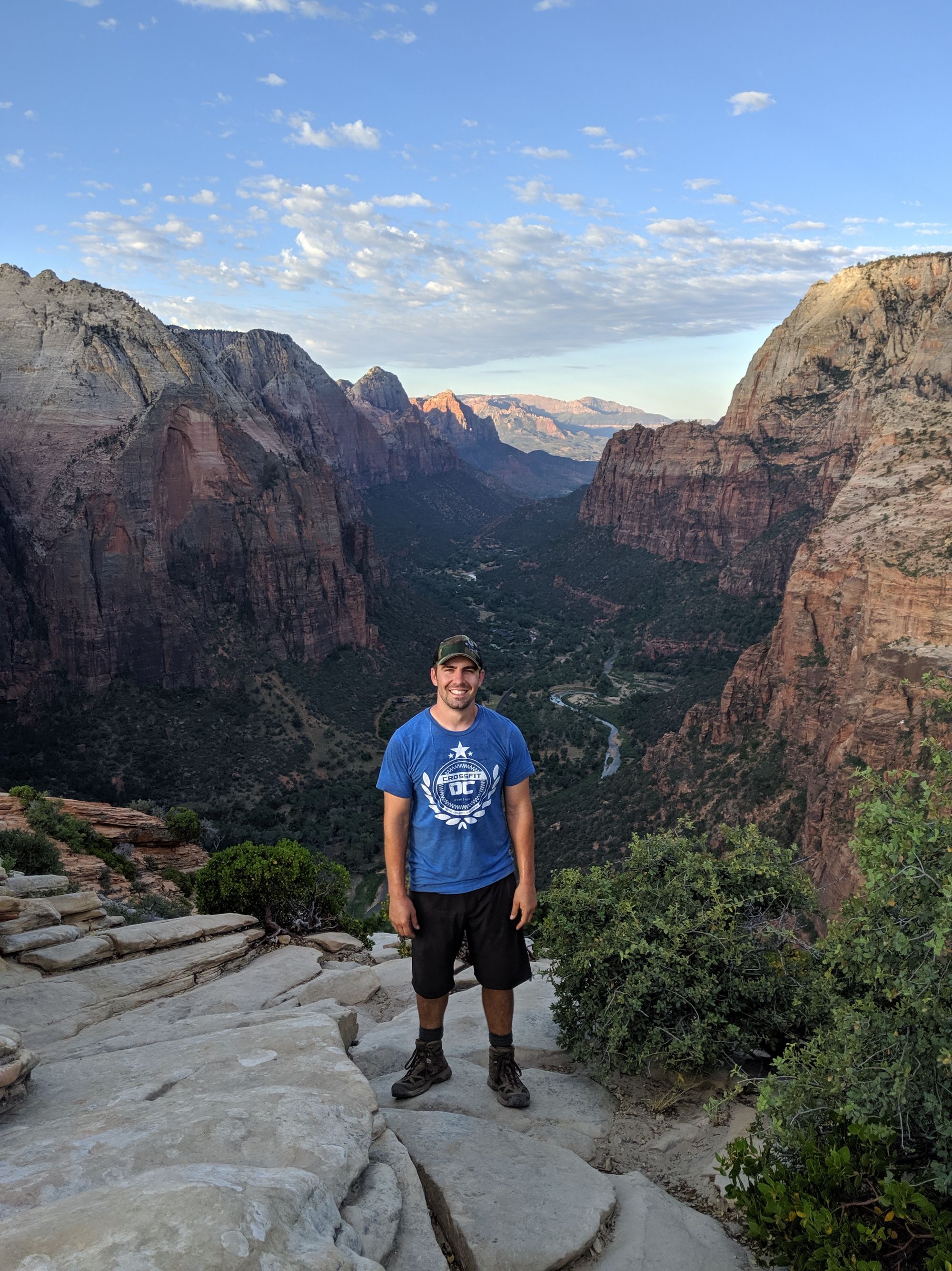
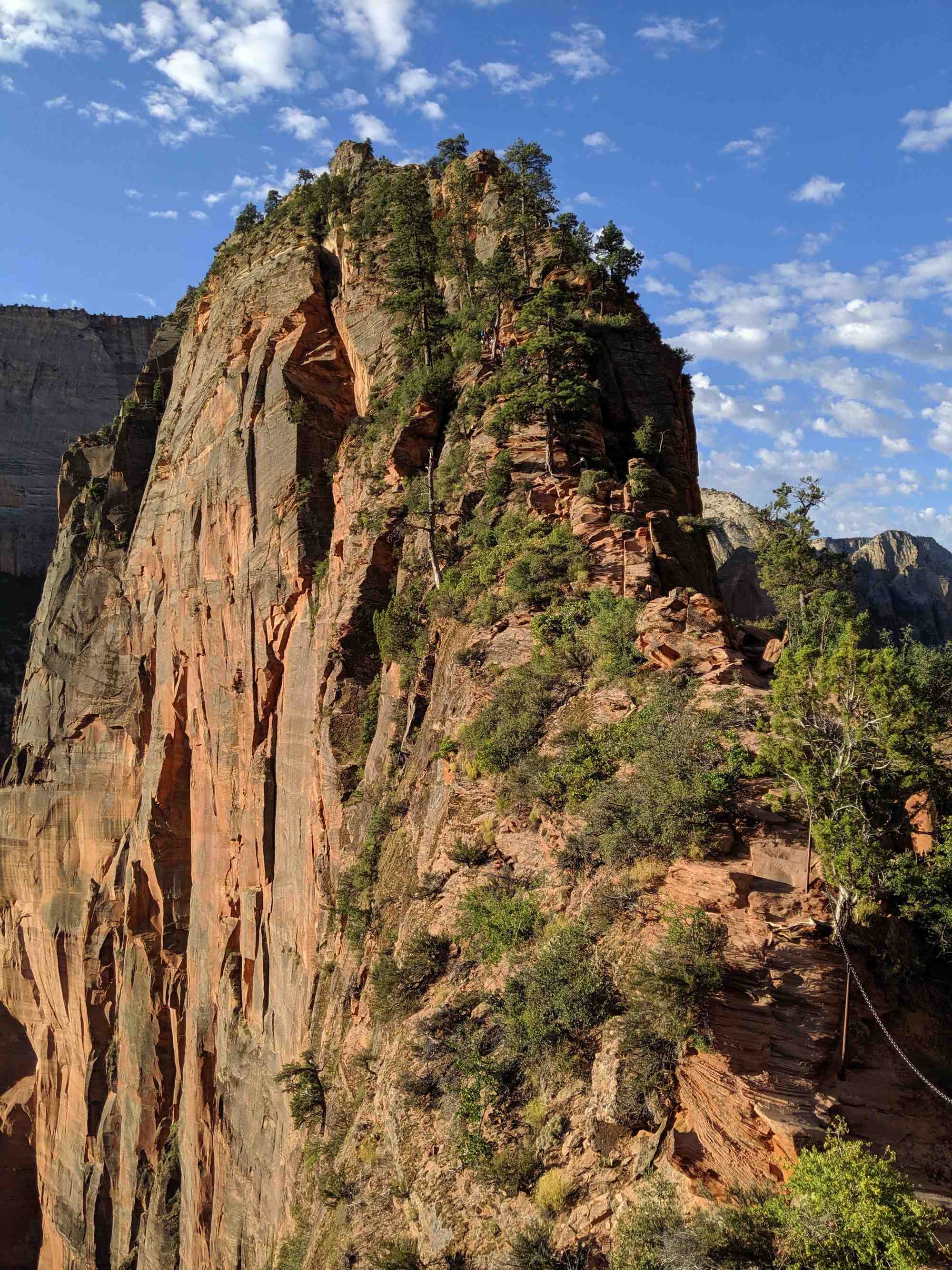
I arrived at Scout Overlook (the junction to the Angel's Landing trail) and I could see a few folks already on their way up...dang! I was not going to be first, but at least I was not going to have to deal with the crowds. The trail up to Angel's Landing is pretty technical and requires the use of hands and feet for almost its entirety. Half a mile of stair-step like climbing to the top was fully worth the spectacular views.
After spending a little bit of time at the top, I had to head back down. My shuttle was 2-hours away and I had no idea how long getting to the bottom would take. The trail down from Angel's Landing involved a lot of stopping and waiting for folks to pass going up (which was expected). I am just glad I did this early on a Monday; I can only imagine how crowded the trail gets on the weekends.
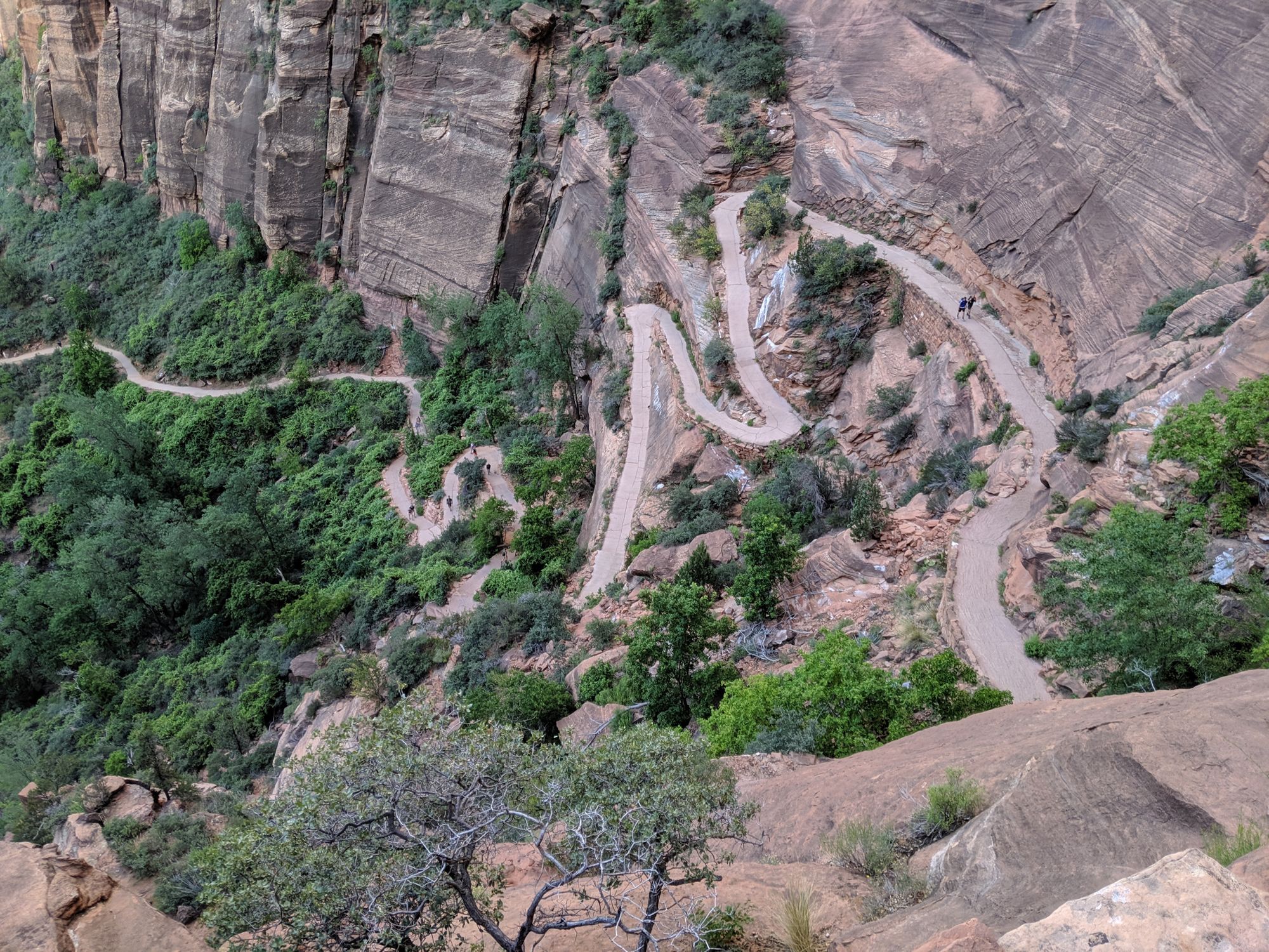
From Angel's Landing, the trail to the bottom of the main canyon was basically switchbacks the entire way as I finished that 3,400 foot descent.
Totally Worth It
Despite the pain and the obvious effort required to complete this trek, the views, the time for reflection, and the challenge made this trip totally worth it. Zion is a beautiful park with much more to offer than just the sites along the main road.
I hope to return someday to do some of the other interesting routes such as The Narrows, The Subway, or any of the other numerous canyons in the park.