Big Bend National Park: Outer Mountain Loop

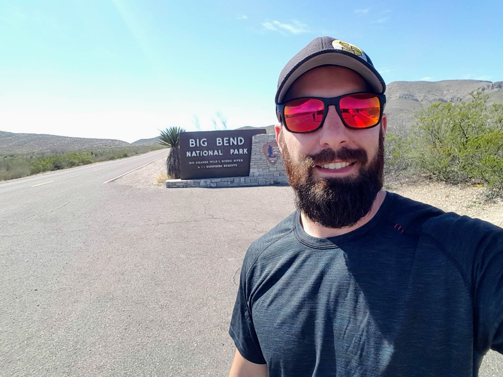
I had about 3.5 days of my first quarter time off leftover after trips to Washington (working vacation) and Hawaii and I desperately wanted to do a backpacking trip in Big Bend. Some quick Googling led me to the Outer Mountain Loop. This trip can be anywhere from 25-45 miles and anywhere from a 1 day sprint to a weeklong excursion. I opted to do the less traditional route of starting at Homer Wilson Ranch and doing the loop counter-clockwise, which is about 30 miles over 3 days. Doing this trip in late February/early March seemed smart too as hiking in Big Bend in the hot summer just does not sound fun.
Preface
This trip was prepended by a trip to Seattle to see New Nephew #1, a trip from Seattle to Hawaii to visit New Nephew #2, a return trip to home (4+ hour flight delay) and a 6.5 hour drive to Big Bend National Park.
Following the trip, I drove to Midland Air and Space Port (as I could not make it back to home base in time for a flight) for a work trip. This flight was delayed, caused a missed connection at DFW, and resulted in an overnight stay in Dallas. After the work trip, I flew back to Midland to finish this odyssey with a 5.5 hour drive back to home base.
Planning
I had initially planned to follow the National Park Service recommended itinerary starting in the Chisos Basin and going clockwise around the loop. However, a last minute work trip meant that I needed to be able to finish up early on the final day in order to get to the airport for a flight.
Based on this I opted to take a recommendation from bigbendchat.com to start at Homer Wilson Ranch. Doing the counter-clockwise loop was based on reported water locations and a shorter/downhill final day on the Blue Creek trail that would get me to the car fairly early.
This would also allow me the option camping on the South Rim and potentially tackling Emory Peak if time/energy allowed. Additionally, I could still fall back on the original plan if all of the designated camping spots on the South Rim were already taken.
bigbendchat.com was a major resource for me while I was planning. I went on the site almost daily researching the routes, water locations, trail maps, and trip reports.
Gear
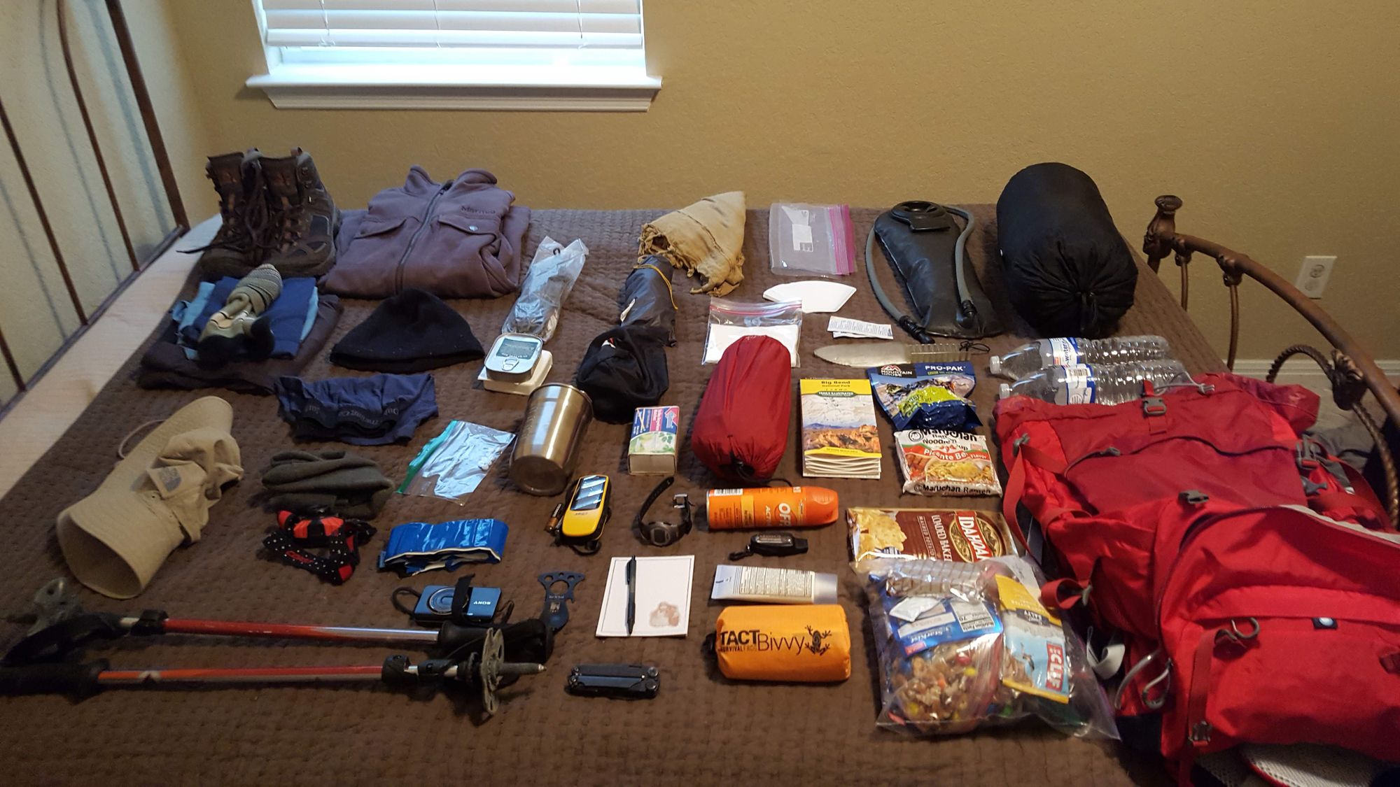
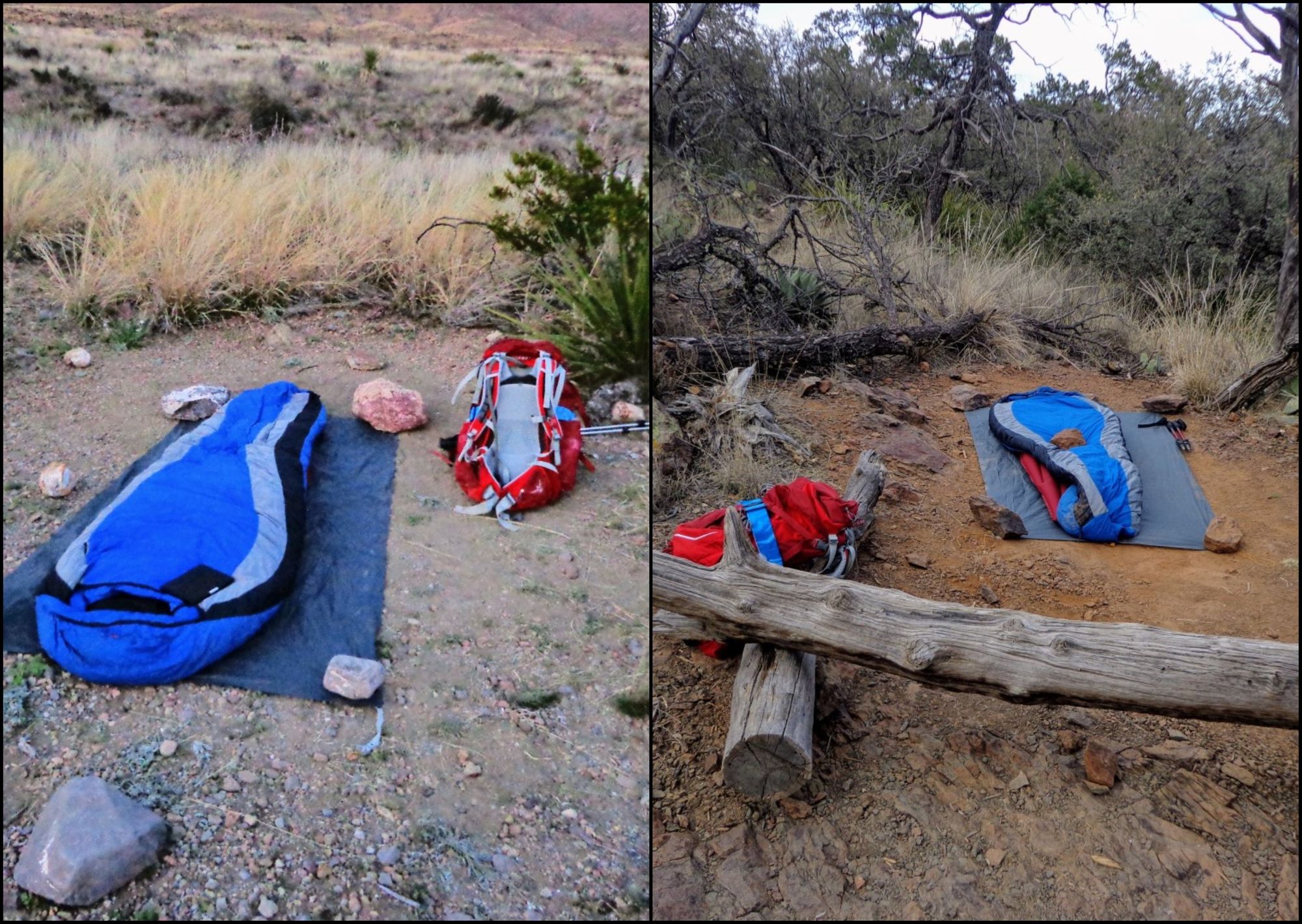
Many recommendations online state that keeping your pack light is the best thing you can do on this trip in order to carry more water and reduce your carrying burden. As such, I opted not to take my tent as storms in Big Bend in the spring are rare. This was my first backpacking trip where I did not take a tent. Due to the potential for low nighttime temperatures though, a full size sleeping bag was necessary. I also needed to figure out my food situation and determine if bringing a stove and cookable food was worth the weight or if just sticking with pre-cooked/shelf-stable food.
In the end, this is what I ended up carrying: https://lighterpack.com/r/evbn29
I threw my Kindle in at the last minute, I was really happy with that decision.
Mi new Osprey Stratos backpack performed great! That pack was so comfortable, there was not a single time during the trip that I felt like my pack was a burden.
Arrival
This trip started after a 4:00 PM arrival (delayed from my expected 11:30 arrival) into San Antonio International Airport from Honolulu. The plan was to have all of my gear ready to go in the car so I could just Uber home, hop in the car, and drive to Big Bend. Because of my planned late start and Big Bend being about 7 hours away, the first night was to be spent in the Chisos Basin campground. There are only a few reservable spots in this campground and when I looked in late January, there were only 2 spots left so I snapped up one of those for $14 to ensure I would have a place to sleep that first night. Turned out this was extremely fortuatous because if arriving at midnight after my flight delay meant there were 0 first come, first served sites left. The nearby Chisos Mountain Lodge has a restaurant so the goal was to arrive in time to get a nice big dinner there. Well that plan did not work due to the flight delay, so I arrived at midnight, climbed in the back seat of my car and went to sleep.
The permits for backcountry hiking and camping can only be obtained in person at the Visitor's Center which closed well before I arrivde and didnot open until 0830 the next morning. So camping in the Basin over night gave me the opportunity get some breakfast at the Lodge before the Visitor's Center opened and to be at the Visitor Center right when they opened to get my permit and start my hike.
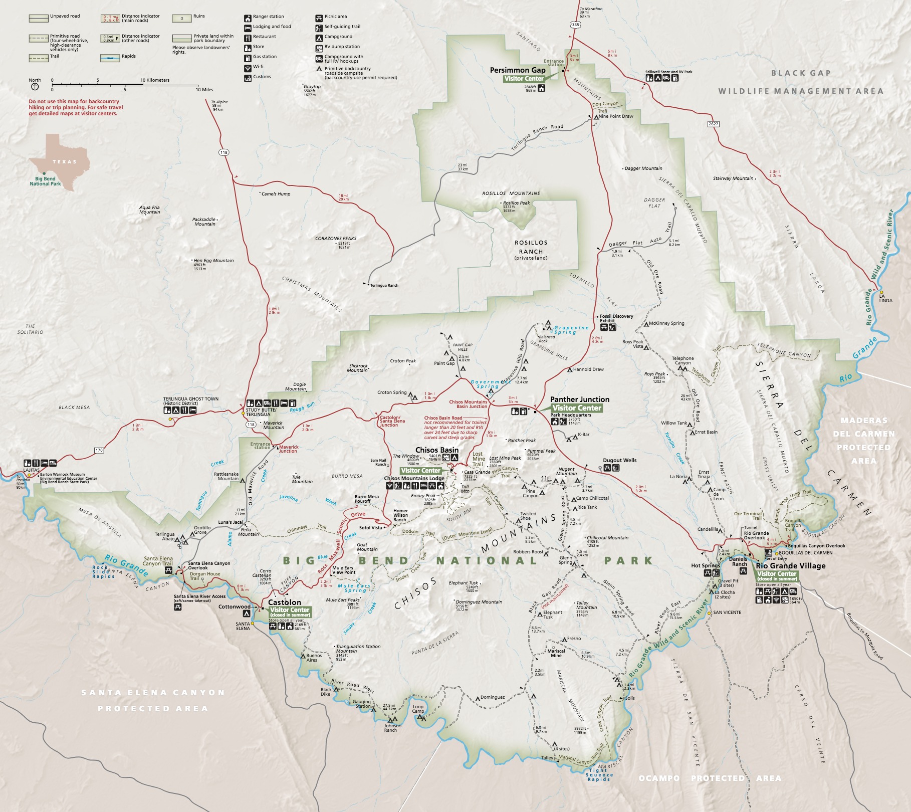
Camping
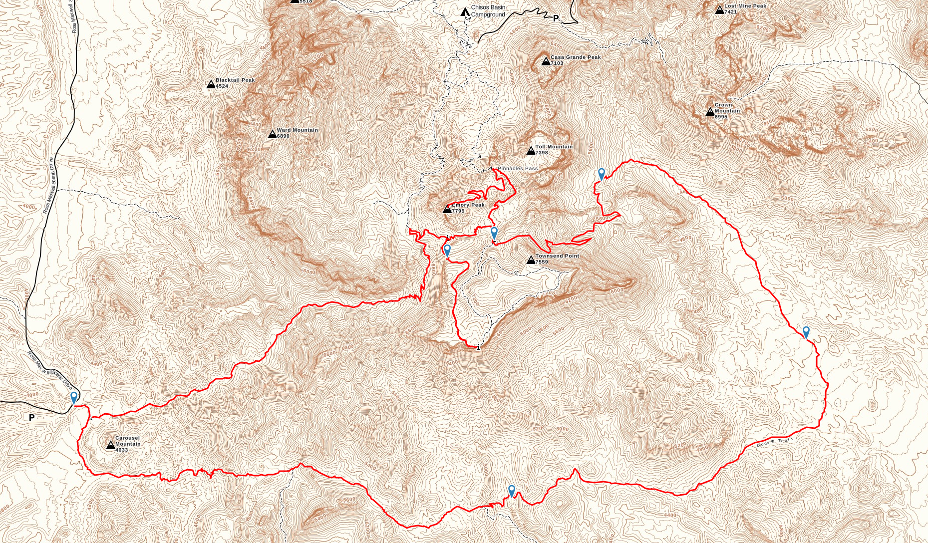
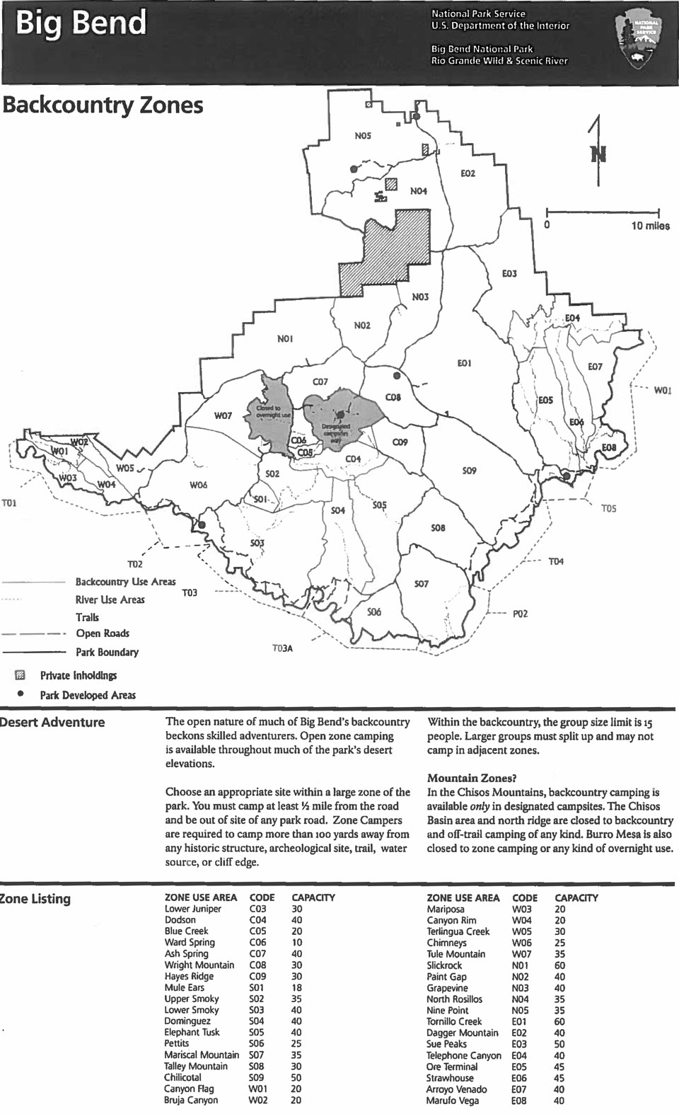
Based on this zone map (took forever to find a decent resolution of this map) and some discussion on BigBendChat.com I wanted to camp in Juniper Canyon just past the Dodson/Juniper Canyon trailhead for the first night on the trail. Since this is zone camping, I did not have any issues getting my permit for this night.
For the second night on the trail I really wanted to camp on the South Rim, but there are only a handful of designated camp sites (fewer during this trip do to closures for Peregrine Falcon nesting season) so there was a possibility I would not be able to get a site. If I could not get a site, I would have had to roll back to the NPS recommended itinerary which included two zone camping nights. As luck would have it, I did get a designated sight (SW2). This site is still about a mile from the South Rim and is 100% visible from the trail (no privacy). Although not as good as SW3 (great view) or SW4 (super close to the Rim), this site still got me close enough to make a sunrise on the Rim a reality.
The Actual Trip
Total Miles: 34.5
Day 1 -The Dodson Trail
12.5 Miles
Day 1 started with waking up in the Chisos Basin, grabbing breakfast at the Chisos Mountain Lodge, and then getting in line for my backcountry permit. I got in line at about 0815 and was the first one there. By 0830 when the doors to the park office opened, there were probably 7 or 8 groups in line. I told the Ranger my plan and he seemed OK with what I wanted to do (other than being upset that I was relying on internet water reports). The only part that did not work out was getting SW3 or SW4 as my campsite for night 2; I got SW2, which was fine, just not the best.
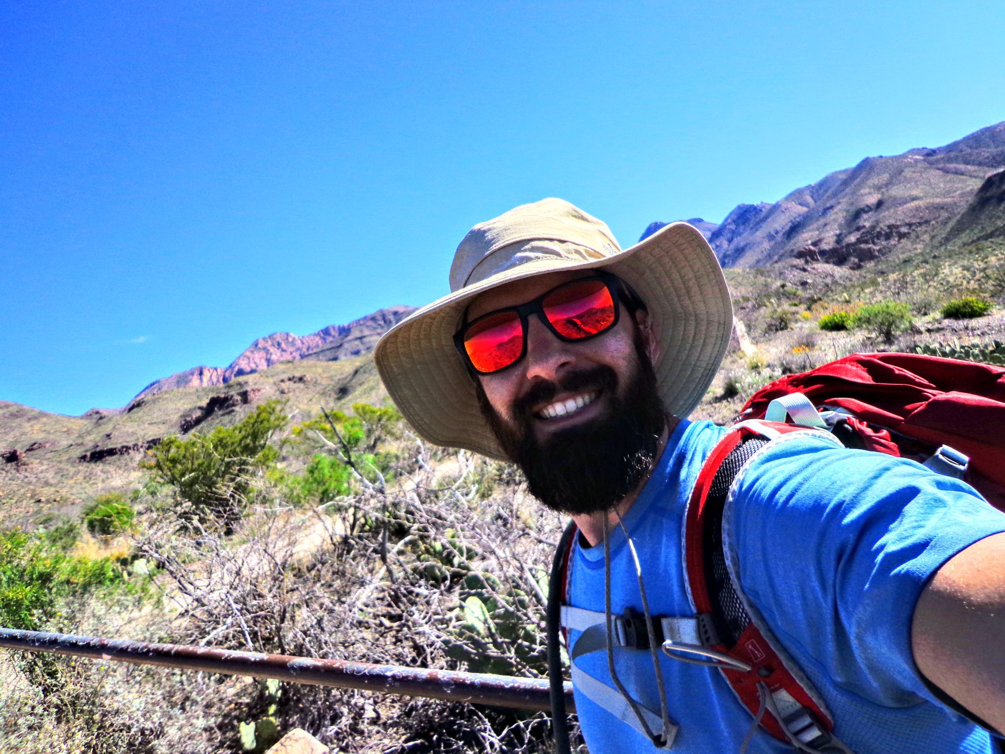
After all that, I hopped in the car and drove over to the trailhead about 30 minutes away. After parking the car and doing some final prep on my gear, I was on the trail by 0950.
Folks online were not kidding, the Dodson Trail has almost ZERO shade for the entire 11.5 miles. The weather that day was perfect though...maybe a little on the warm side, but a light breeze kept me at a comfortable temperature for almost the entire day.
I crossed 2 almost dry streams and got a bit nervous that either one might have been the Fresno Creek where I was expecting to fill up with water. Then I ran into a father/daughter group who informed me that the Fresno was a little further on. I finally found it and took my first break of the day for lunch and water.
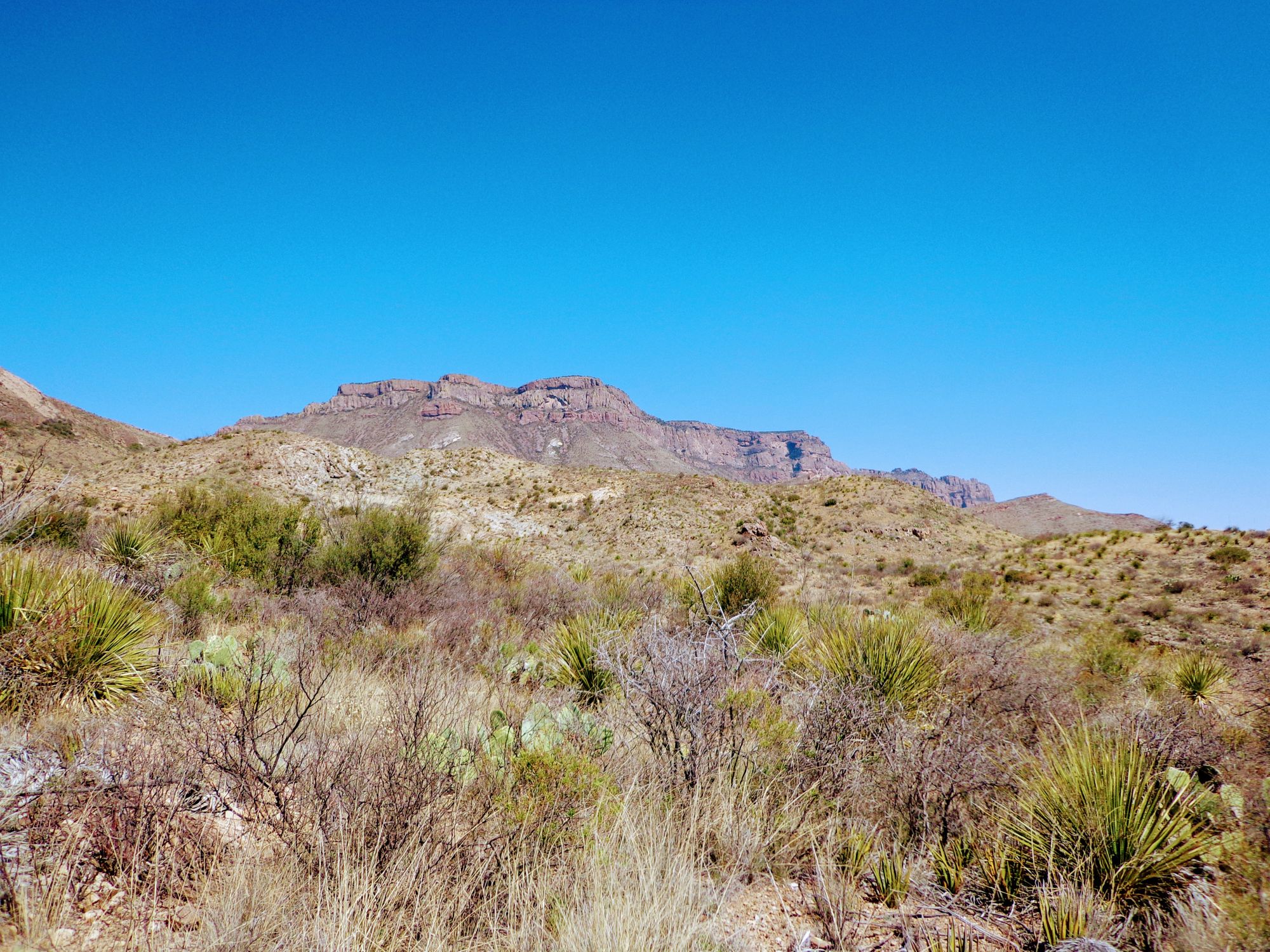
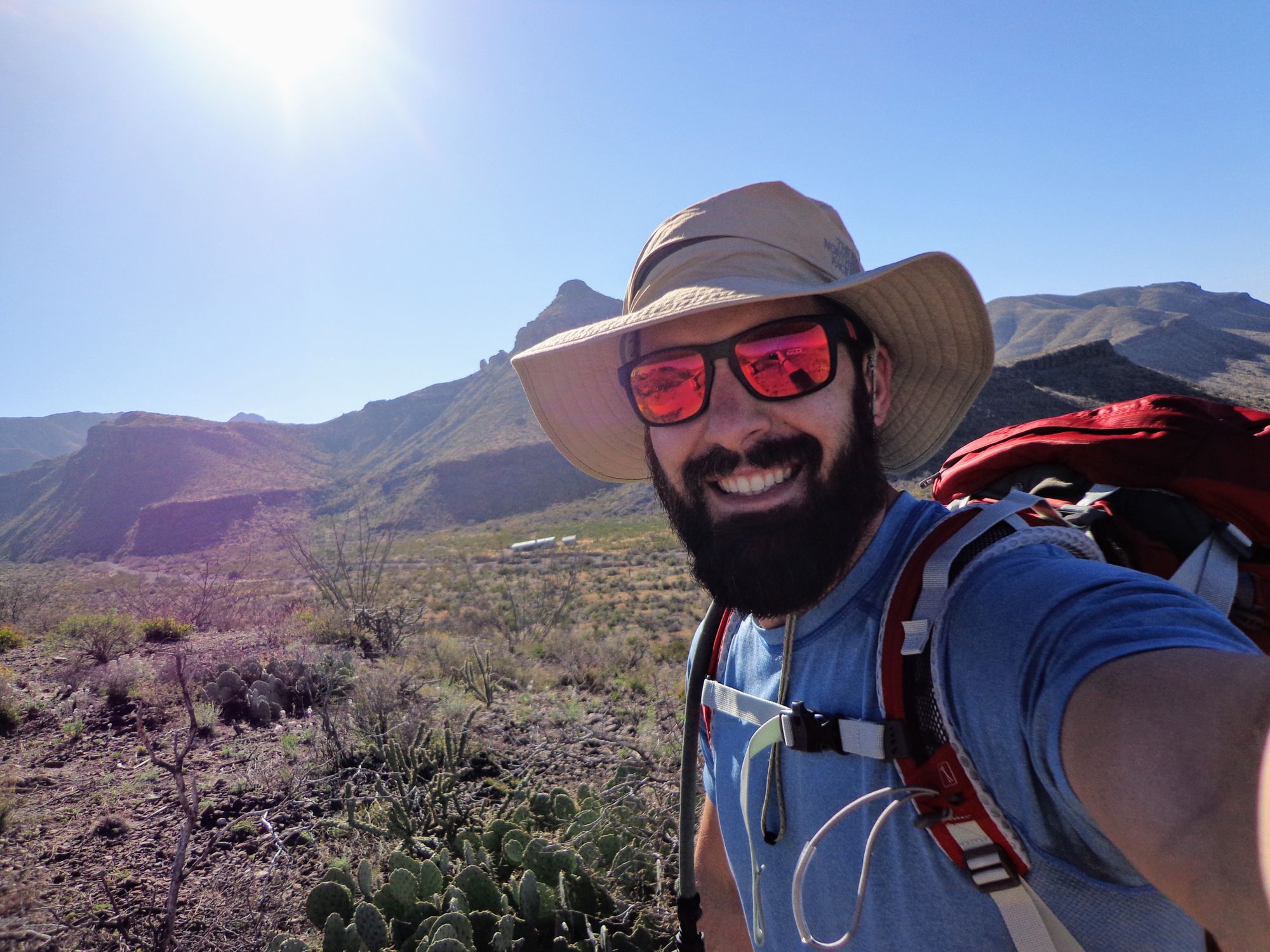
The rest of the day was without issue. I was awed by the landscape and even more so when I was finally able to see the South Rim, where I would be heading the next evening.
I made it to the Dodson/Juniper Canyon trailhead at about 1600 where there was a large group getting ready to head out. I hiked a bit further up the Juniper Canyon trail to find a camping spot. After initial selecting a rocky spot and talking to a passer-by, I continued another quarter mile or so up the trail to find a nice soft spot to make camp.
The night was amazingly clear and I set up my pad facing the Big Dipper so as I would wake up through the night, I was able to watch the constellation move across the sky. I saw many shooting stars and a few satellites.
Day 2 - Juniper Canyon and Emory Peak
13 Miles
On day two I rose just as the sun was coming up. Made myself some coffee and oatmeal, and hit the trail. This day was likely going to be the hardest day because this is where all of my elevation gain was going to happen as I hiked up into the Chisos Mountains. The first half of the Juniper Canyon trail is pretty flat but turns steep after a few miles.
I was surprised as I started to hike up into the mountains how quickly I was rising. Each time I would turn around to see where I had been I felt way higher looking back than I did from the effort I had put in.
I eventually found the Zone Camping sign that also indicates the trail to Juniper Spring and was able to easily find the spring and top off my water. This was probably an unnecessary stop though, as a little while later, as I finished the Juniper Canyon portion of this day's hike, I came up to Boot Spring. There was a nice area to take a break and eat lunch just up the hill from the spring.
At this point I had a couple options: 1) Go to my campsite and then decide if I wanted to hike all the way back to Emory Peak to do that trail or go straight to Emory Peak and hike it with my pack. As luck would have it I got to chatting to a fellow hiker who told me that there were bear boxes at the bottom of Emory Peak to stash packs in. Well, that made up my mind, I could hike right there, saving myself at least 2 miles of unnecessary hiking.
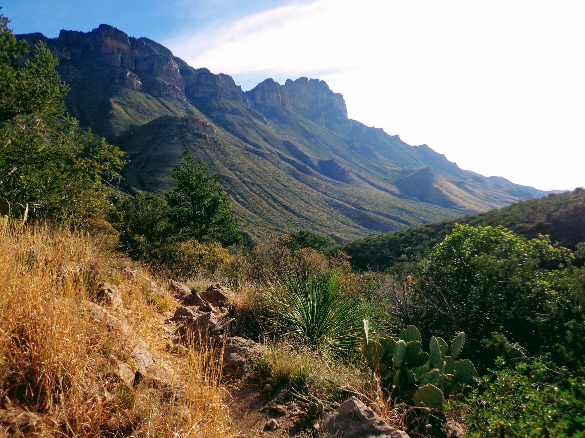
The Emory Peak trail is pretty exposed and I drank almost a full liter of water along the way. The views from the top were amazing being able to see the Chisos Basin, the desert where I had hiked the Dodson, Mexico, and all the surrounding mountains. The scramble to the top was pretty fun as I actually had to climb a bit.
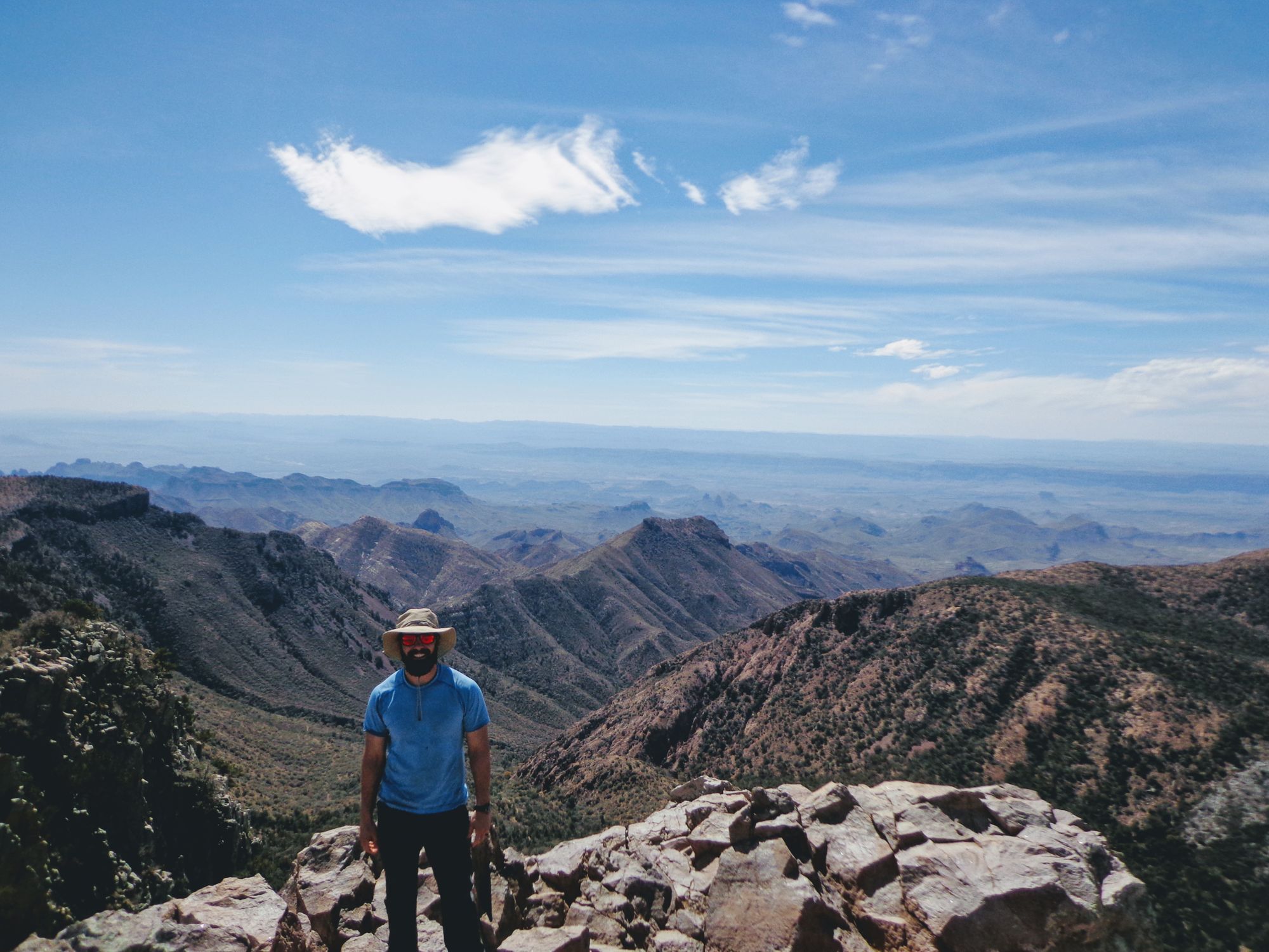
After finishing the Peak, I went back to Boot Spring to top off my water for the night as this was going to be my last water stop of the hike and had to last me until I returned to the car. I then made my way to my campsite. I had some extra daylight left so I decided to go take a peak at the South Rim in the evening (even though my true goal was to see it at sunrise). I was in awe of the view and I was stupid enough to leave my phone and camera at my campsite. This was kind of nice though as I was able to just enjoy the view with no distractions.
My Mountain House lasagna dinner on night 2 was amazing. I read my book a little bit and turned in for the night. Unfortunately, clouds made start gazing on this night not nearly as amazing as night one.
Day 3 - South Rim Sunrise and Blue Creek Trail
8.5 Miles
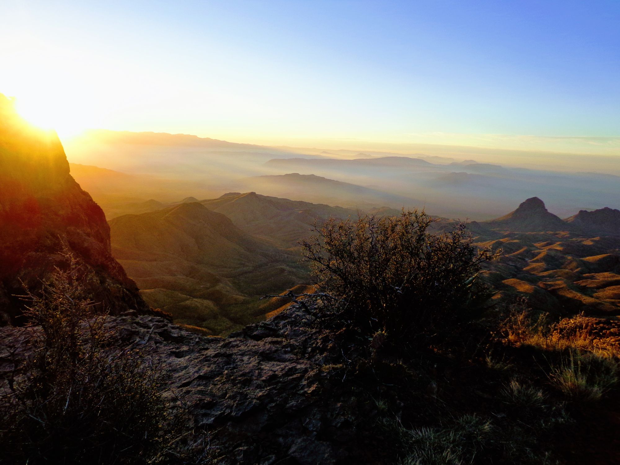
I woke early on Day 3 to get my camp packed up and ready to go so that I could depart immediately after heading up to the South Rim to see sunrise. I made myself some coffee and set off for the Rim. Luck put me on the Rim just as the sun started to come over the mountains in the distance. The view of the desert below was outstanding. I was all alone on the Rim, which to me was unexpected but I appreciated the opportunity to enjoy the whole place to myself.
After spending some time on the Rim, I set off back to camp to get my pack and begin my hike back to the car. My itinerary made day 3 the shortest and easiest day so that I could get to the car early for my 5 hour drive to Midland Airport. The hike was easy and quick but I am glad I did it downhill.
Blue Creek trail seemed much steeper than Juniper Canyon Trail and the bottom portion of the trail is all gravelly river bed. The soft ground did not bother me so much going down, but going up that gravel would have been killer. I kept thinking I was going to round a bend and see the car but they kept coming until finally I was able to see the roof of Homer Wilson Ranch.
I was back to the car by just after 1100. I was beat, my feet hurt, and I was so glad that I had done this hike. I had a blast on this hike and got to see some really amazing scenery. I would recommend it to anyone who is in the Big Bend area.
Observations/Lessons Learned
- Get a new GPS. Mine died after day 1. Not that it was so necessary, as I had a map with me, but I was sad that I would not be able to accurately track my mileage and time on the trail.
- Get a lightweight solar phone charger. This would negate the need for a GPS, Kindle, and camera probably at a lighter weight too. I have used the Gaia GPS app on my phone for shorter hikes and I think it would have been a great option for this trip if I could have charged my phone.
- Loneliness. I got super lonely in the evenings after I stopped hiking and before going to bed. Luckily I threw my Kindle in my pack at the last minute, so that helped. I think that perhaps I need to find hiking partners for future hikes. I did not feel alone at all while hiking or in the mornings but the down time of the evenings was crushing. Perhaps I was just missing my family.
- Too much food. I ended up with almost half of my food remaining. Mostly it was my snacks, as my meals were a little better planned. I will likely bring fewer snacks in the future.
- Upgrade equipment. My equipment is heavy compared to newer versions. I need to invest in some lighter equipment, specifically my sleeping bag, sleeping pad, and tent (not used this trip).
Resources
NPS Recommended Itinerary
Chisos Mountains Backcountry Camping Guide
- Page 5: Campsite Map
Big Bend NP Map
Big Bend NP Backcountry Zone Map
The Outer Mountain Loop FAQ and planning tips (from bigbendchat.com)
Detailed Topographical Maps (from bigbendchat.com)
Recent Trip Report from ckrenitsky
REI Pack Weight Article
REI Meal Planning Article